Showcase
- NZILA Award of Excellence Student — 2024
This Thesis project was nominated by the Landscape Architecture faculty at Victoria University of Wellington.
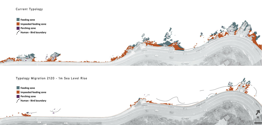
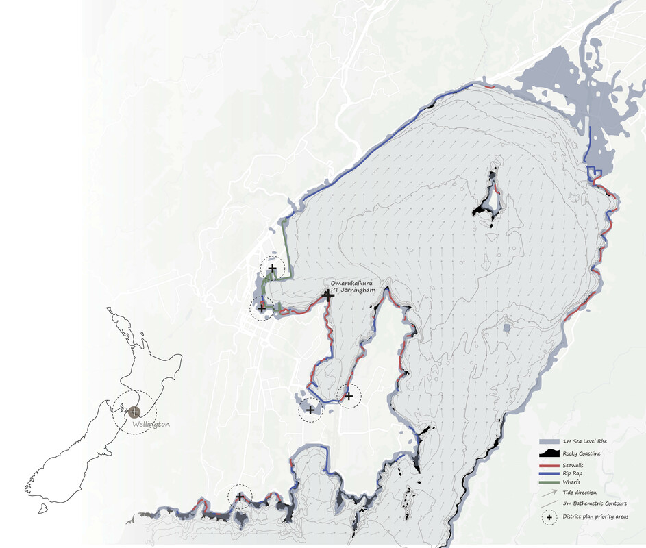
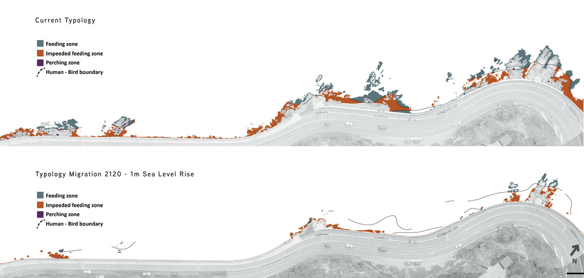
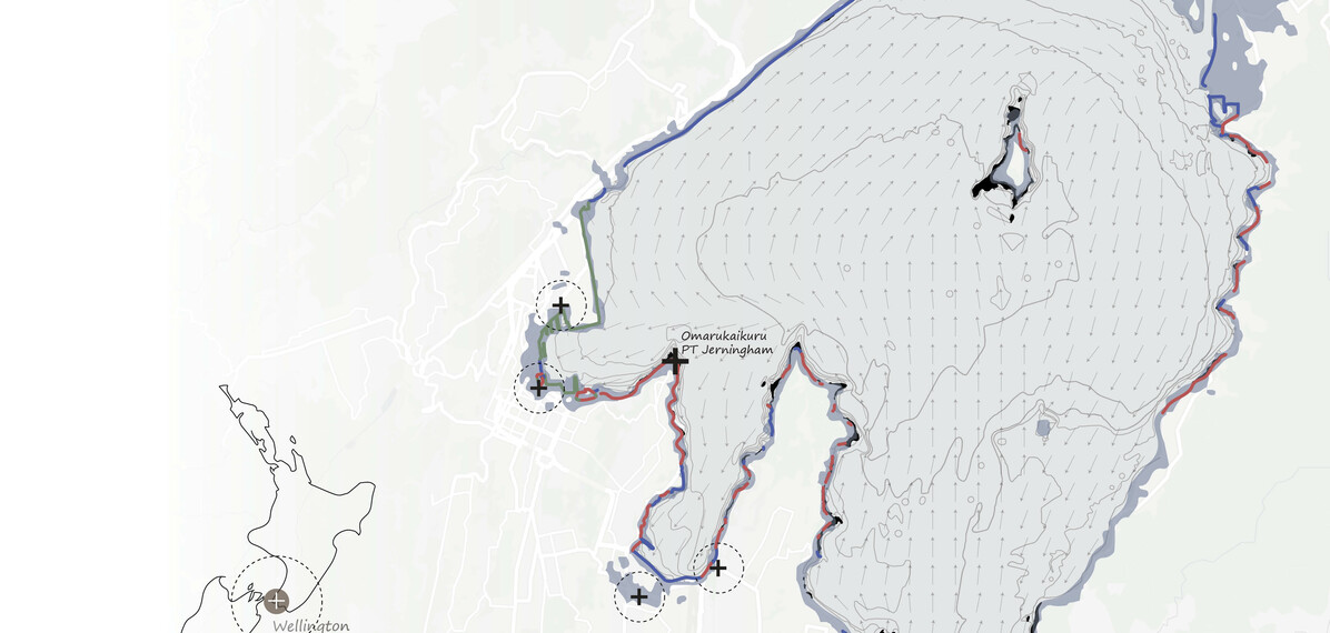
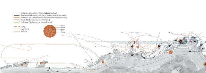
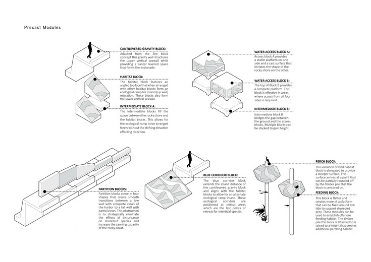
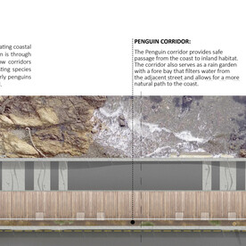
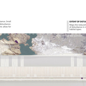
This project shows how design can minimise the restriction of inland migration of intertidal species along urban coastlines; especially where coastal infrastructure such as seawalls have been created. Research includes mapping species distribution and behaviour as well as testing design prototypes that increase habitat for intertidal species.
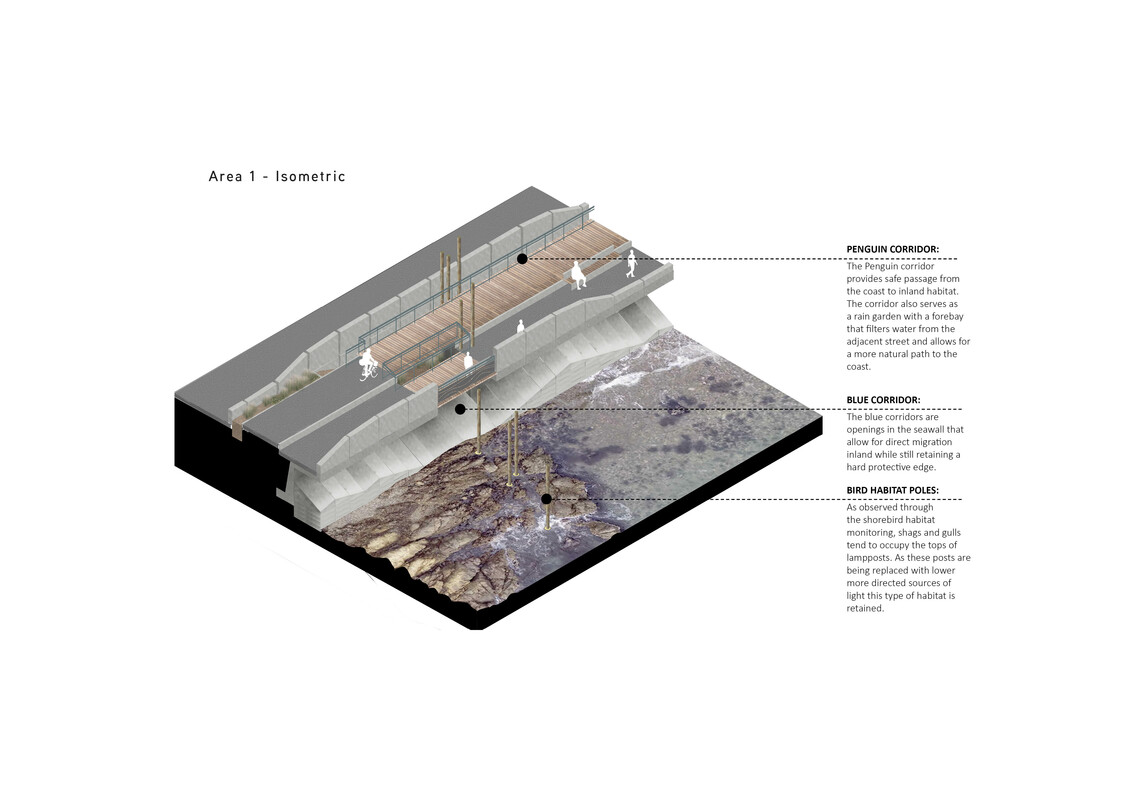
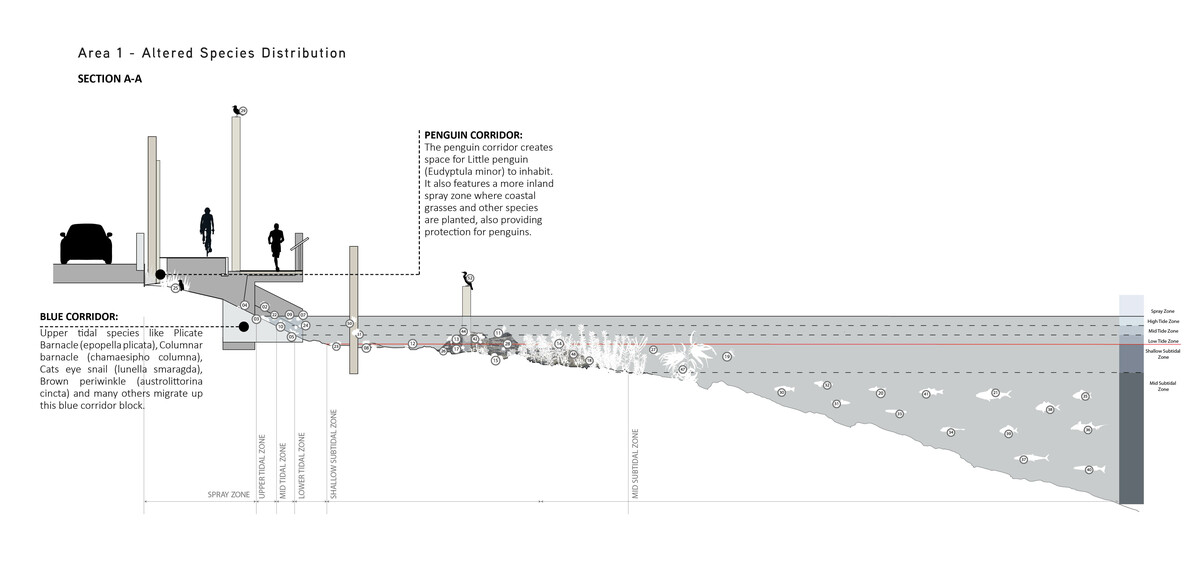
Design outcomes include penguin passage corridors, intertidal habitat corridors for shellfish, and bird habitat poles. This project stands out for its clear presentation, articulation of issues, communication of design considerations, and potential to influence sea wall development in urban areas.
Connor McKeown
All images