News
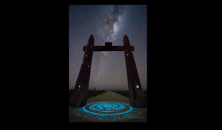
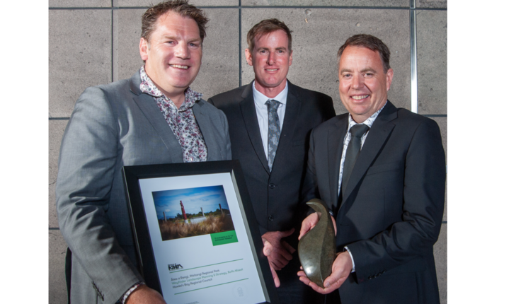
Ātea a Rangi, Waitangi Regional Park - 2019 Resene NZILA award winner
Posted 12 11 2019
in News
![Local carvers have created the pou, representing the points of the compass.](/media/cache/6d/4f/6d4f85895a55646dcff2acda2a32640d.jpg)
Watch video
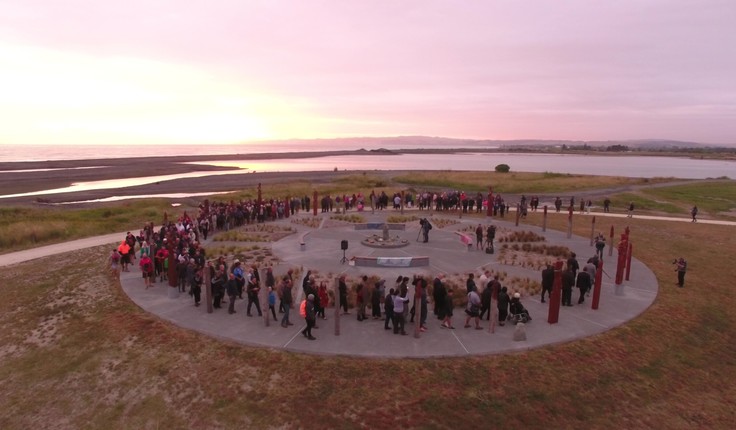
Ātea a Rangi, Waitangi Regional Park by Boffa Miskell and Wayfinder Landscape Planning & Strategy, has won Te Karanga o te Tui category in this year’s Resene New Zealand Institute of Landscape Architecture Awards.
The star compass and wetland restoration project for the Hawke’s Bay Regional Council was described as a “triumphant cultural landscape and environmental project giving rise to the knowledge and understanding of Māori sky lore” by the judges.
They noted that the location at Waitangi Regional Park and the wider coastal shores of Te Moana-nui-a-Kiwa provided a poignant setting to the discovery and practice of traditional Māori celestial navigation techniques.
![Ātea a Rangi was constructed as one of several elements in the Waitangi Estuary enhancement at Waitangi Regional Park. The overarching objective of the enhancement is to promote respectful use of the Waitangi estuary.](/media/cache/17/a6/17a611d4857f65c301c4ff44dd64f447.jpg)
![Shannon Bray, NZILA (left), Russell Engelke Open Spaces Manager, HBRC (centre), Steve Cave (right)](/media/cache/9d/0d/9d0d822af1a132fde6d824fde1bcffa5.png)
“It also provides a place for people of all cultures to reconnect with the natural processes of the surrounding world in the Aotearoa context,” the judges citation read. “The sky, sounds, winds, coastal smells and connections through pou to the greater landscape contribute to a tangible and deeper understanding of Te Ao Māori.”
Lead carvers Nathan Foote and Philip Belcher carved the compass, and while Piripe Smith donated his time to the project, passing on the traditional knowledge within Te Moana-nui-a-Kiwa and wider Aotearoa.
You can read more about the project and watch the video to hear further comment from the judges here.
Share
10 Jul
Slipping Underwater
![Catchments in the top of the South Island, bottom of the North Island. Source data: MfE Data Service (data.mfe.govt.nz) and LINZ Data Service (data.linz.govt.nz). Analysis and visualisation: Toitū Te Whenua Land Information New Zealand.](/media/cache/75/bc/75bc2cdd2c09a05b984e92691f56f383.png)
New report from the Parliamentary Commissioner for the Environment
While New Zealand has plenty of freshwater, we are heavy users of this resource. Our water use is changing the …
09 Jul
Marko den Breems appointed as Isthmus CEO
![Marko den Breems](/media/cache/77/fe/77fe0d6c3d36274128b0878117b3d0d3.jpg)
Isthmus’ Board are thrilled to announce that Marko den Breems has been appointed to the role of Chief Executive Officer. …
08 Jul
Waiaroha wins supreme local government award
![Image: uploads/2024_07/ScaleWidthWyI1MDAiXQ-Waiaroha-Taituara-award.jpg](/media/cache/58/59/5859077eb3202e2e1ffdcfe13818f21f.jpg)
Heretaunga Hastings District Council Feature
Hastings District Council’s primary drinking water treatment and storage facility, Waiaroha, received national recognition last night – winning the Taituarā …
Events calendar
Full 2024 calendar