News
Pathway of Wetland Habitat Restoration Continues at Waitangi
Posted 25 03 2019
in News
Te Tau-a-Nuku article
Following many years of neglect a new river focused park is being developed at Waitangi in Hawkes Bay by the Hawkes Bay Regional Council in conjunction with tangata whenua. Te Tau-a-Nuku member Antony Rewcastle (Ngati Mahuta and Ngati Pukeko) gives the inside story.
Heretaunga ararau
Heretaunga haukunui
Heretaunga haaro te Kaahu
Heretaunga takoto noa
Heretaunga of a hundred pathways (diversity)
Heretaunga of the life-giving waters (fertility)
Heretaunga - the true beauty of which can only be seen through the eyes of the hawk
This whakatauaki reminds us to maintain an expansive, holistic and forward looking view in all that we undertake. It also reminds us of the beauty and abundance of the rich landscape and the multiple pathways, and choices that presents to all of us.[1]
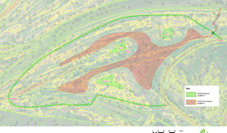
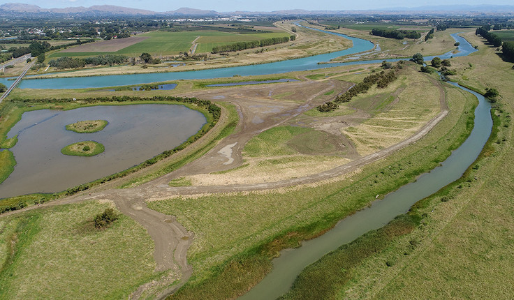
Kāhu (hawks) continue to monitor progress as 15 hectares of new wetland habitat is being created at Waitangi Regional Park in Hawkes Bay, where a community partnership model is funding construction of the wetland in the flood plain of the Tūtaekurī and Ngaruroro rivers near the coast at Awatoto. While there is strong interest from the community, the design has a focus on creating wildlife habitat for shy native species, without human disturbance, rather than providing public recreational opportunities.
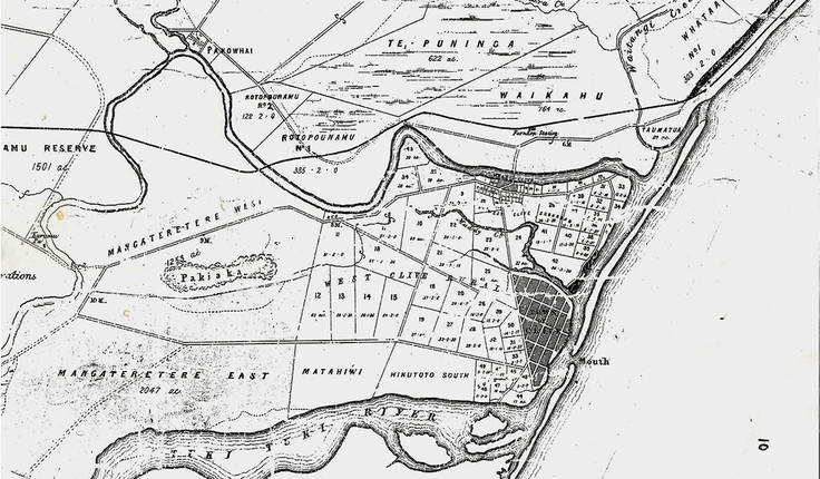
Four major rivers meet at Waitangi Regional Park: the Tūtaekurī, Ngaruroro, Old Ngaruroro (Karamū-Clive), and the Tukituki. The area was an important entry for waka and ships to the network of streams that reach to the Kaweka and Ruahine ranges, and were trading routes to inland settlements. The Takitimu waka landed here, as did the HMS Endeavour, and the HMS Herald, upon which the Treaty of Waitangi was signed on 24 June 1840. It is still considered a meeting place, centrally located between the cities of Hastings and Napier.
These waterways have a long history of changing course and the site has been subject to flooding so that ‘flood control’ work is now a feature of the landscape. The Tūtaekurī River was diverted to this estuary after the 1931 earthquake, and in 1970 the Ngaruroro was diverted from Pākōwhai to share its alignment.
The inland wetland was known as ‘Waikahu’, meaning to cloak in water, or amniotic fluid. Since colonisation approximately 98% of Hawke’s Bay’s wetlands have been lost, which makes the interconnected mouths of these four rivers particularly important both ecologically and in recreational terms. The area is valued for water sports (including waka ama, rowing, kite surfing, and jet boating). It is popular for fishing, white baiting, and duck shooting. It is also becoming increasingly valued for its wildlife. Recent developments have raised awareness of wetland restoration, including the Ātea a Rangi (star compass) and a pathway connecting Haumoana to Awatoto along the coast and on to inland destinations. These connections will be used again for the HB Marathon on the
18 May 2019.
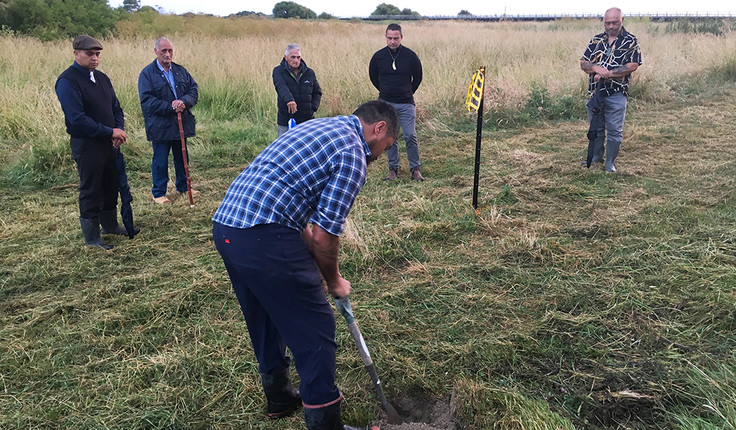
The vision for this new wetland was initiated around 15 years ago, and an old stop bank was filled in 2009 to create the adjacent Horseshoe Wetland. The project partners are Te Wai Mauri Trust (providing Te Wai Māori funding), Ngā Hapū o Tūtaekuri (Waiohiki, Moteo and Wharerangi Marae), Ngāti Kahungunu Iwi Incorporated, Kohupātiki Marae, Matahiwi Marae, Napier Port and Hawke’s Bay Regional Council which is managing the project.
The overarching purpose of the project is to assist in restoring freshwater mahinga kai species, by creating wildlife habitat, in an estuary area identified as being important for whitebait spawning, tuna, patiki, and matuku hūrepo (Australasian bittern). This will also support the rich feeding grounds of coastal fish species. An expected benefit is to help reconnect whanau and hapū with their awa, and mahinga kai harvest practices through education and an improved fishery.
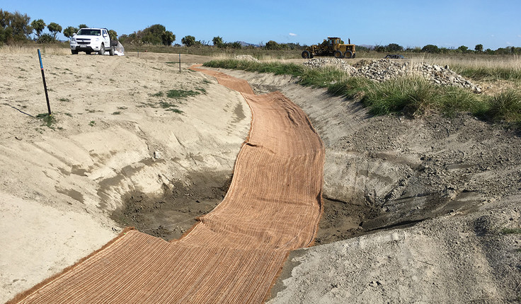
The cattle which have grazed the area since around the time William Colenso arrived, have been moved on. A key element of the new wetland is the 1.5km ‘bund’ or small stopbank which encircles 15 hectares of low-lying flood plain. This bund contains water supplied by rainfall and a bore but also provides resilience by protecting the wetland from high river flows. The project aims to improve water quality and manage levels using aquifer groundwater via a bore to supply the bunded area. Following work on similar wetland projects and challenges in the region, leading experts in wetland habitat construction and fish passage collaborated to design the outlet weir, between the wetland and the Tūtaekurī, as a series of pools and swales (using organic materials of coconut mat and river stones). This allows fish a chance to rest on their journey. Strippings from excess earthworks material have been used to create three islands within the flooded area for wildlife refuge.
There has been strong support and enthusiasm from sponsors and project partners. The earthworks contractors showed great passion for this environmental project on home soil after having past experience in the overseas mining industry.
Native coastal planting around the edges of the new wetland will be a key element of habitat and earthworks protection. Community planting days are proposed for this winter, where the community can get involved like they have with other waterway enhancement sites nearby.
Each wetland project will have unique challenges, but this felt like we are developing a template to improve efficiencies, knowledge and success for further restoration on other sites within the region. Restoration is a key goal in a number of local iwi and hapu management plans. Whereas the area would previously have been a source of mana for ability to manaaki manuhiri[2], it is now seen as a source of mana to have clean and swimmable waterways and healthy biodiversity.
Antony Rewcastle, HBRC project manager
Antony Rewcastle is a Landscape Architect at Hawkes Bay Regional Council, and a member of Te Tau-a-Nuku - which is a collective of Māori Landscape Architects and a member of Nga Aho.
[1] http://www.ttoh.iwi.nz/our-story/our-vision-and-mission
[2] Generously host visitors